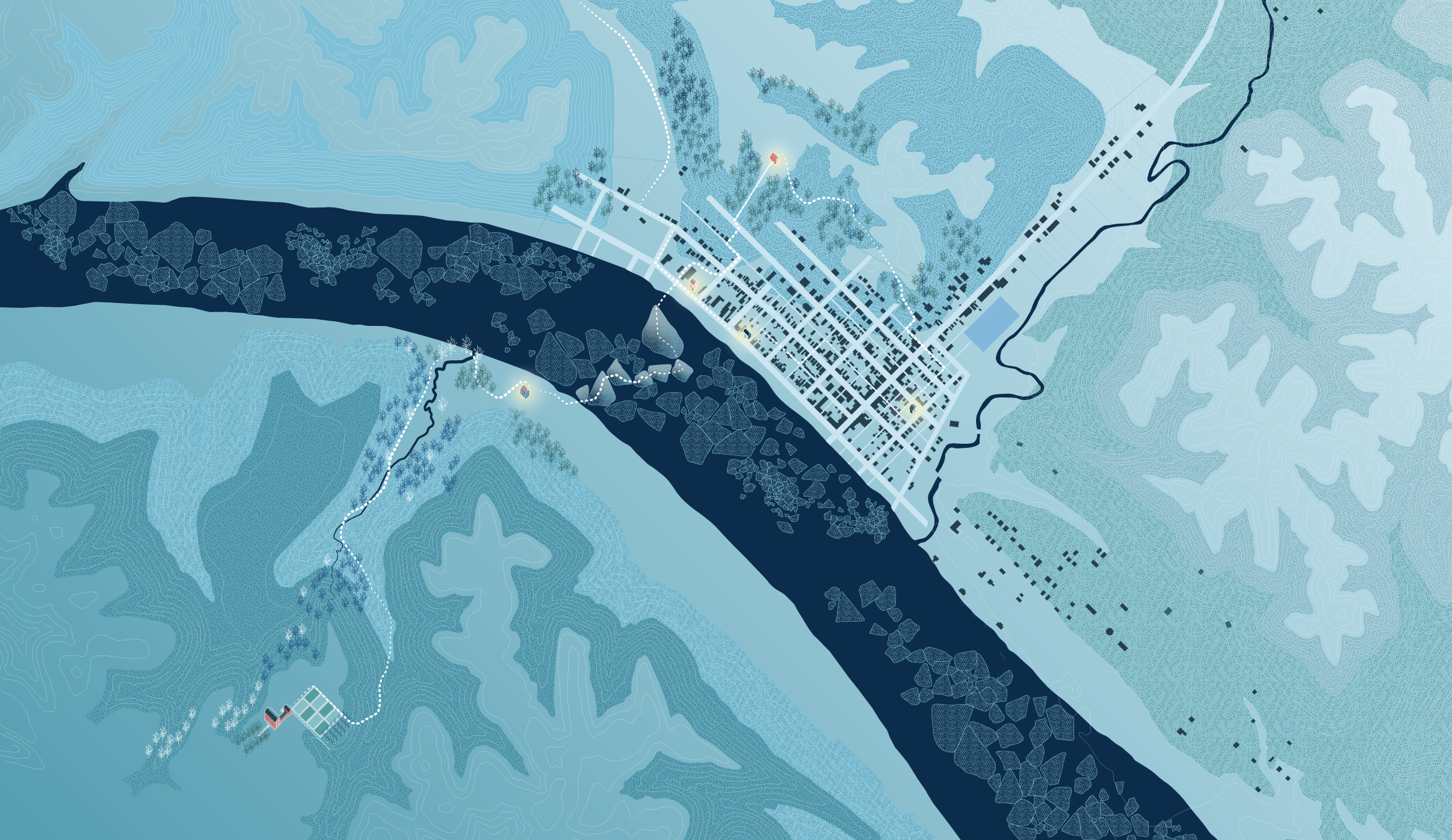
This map traces the phases of Eliza Harris's journey—crossing the Ohio River on ice floes, arriving at Ripley, moving north toward liberation in Canada. The white line does not claim certainty. It traces the probable, the approximate, the human scale of a journey that had to be invisible—and now just barely isn't.
Crossings: Mapping American Journeys
Newberry Library, Chicago · 2022
Was This a Station?
Thompson Library, Ohio State · 2024
Was This a Station?
Columbus Metropolitan Library · 2025
David Rumsey Map Library
Stanford University
[year] Watch →
American Geographical Society Library
University of Wisconsin–Milwaukee
[year] Watch →
The Portolan: Journal of the Washington Map Society
[issue, year] Read →
Imago Mundi
[issue, year] Read →
The journey line was revised in 2026 from its original form. Where the earlier version used a red dashed line—a cartographic convention inherited from military mapping—the revised version uses white, with a fluid rather than continuous profile. The change is methodological: the line should carry the uncertainty of the journey, not the precision of a command.
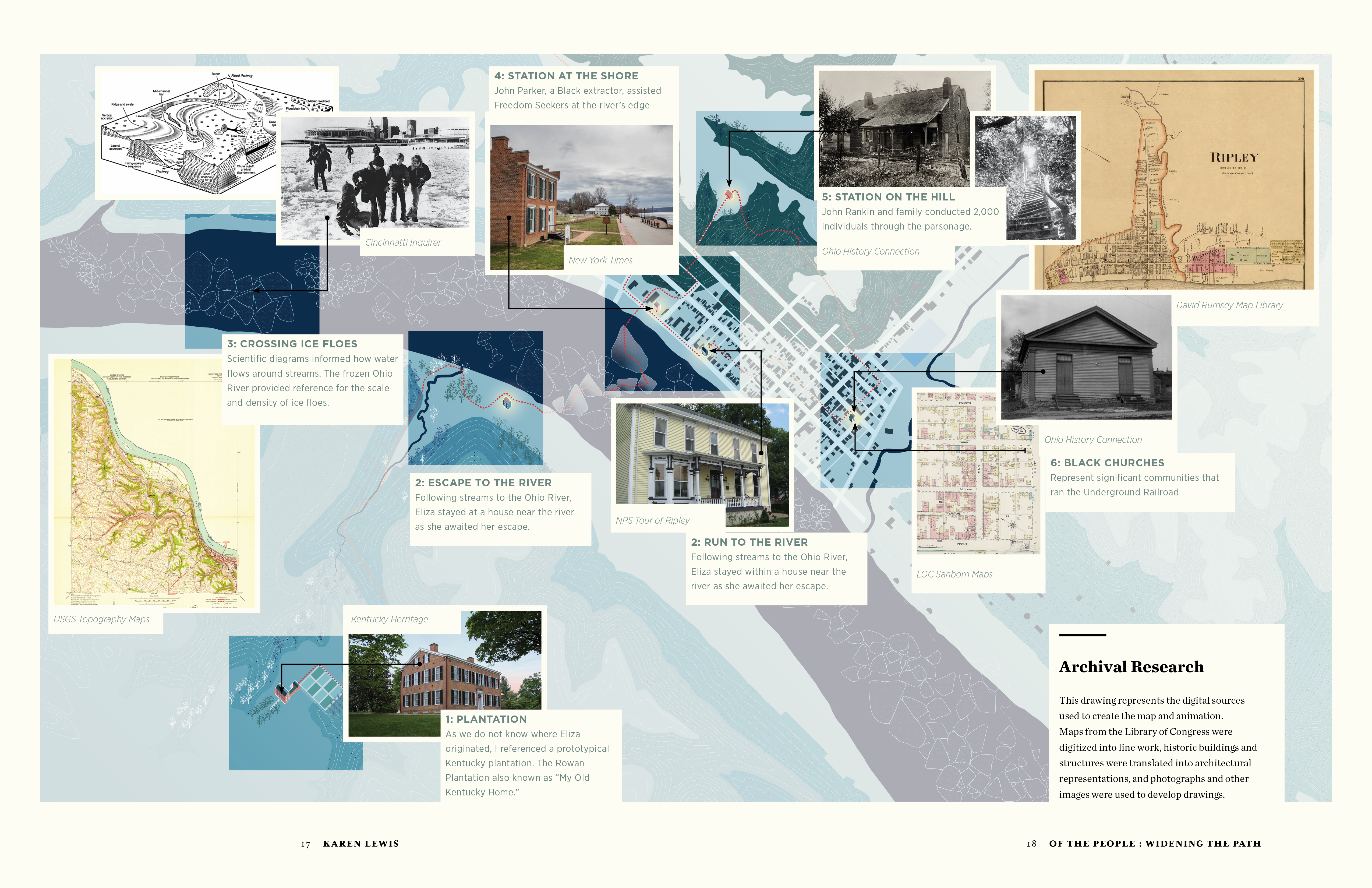
This drawing represents the digital sources used to create the map and animation. Maps from the Library of Congress were digitized into line work, historic buildings and structures were translated into architectural representations, and photographs and other images were used to develop drawings. Each source is positioned spatially—mapped to the territory it informed.
You might be familiar with the story of Eliza Harris. Eliza was an enslaved Black woman in Kentucky who, when hearing that her child was to be sold to another family of enslavers, escaped in the night through the wintry Kentucky landscape to the Ohio River—where she planned to walk across the frozen river to Ohio with her baby in her arms. Her experiences were dramatized in Harriet Beecher Stowe's Uncle Tom's Cabin.
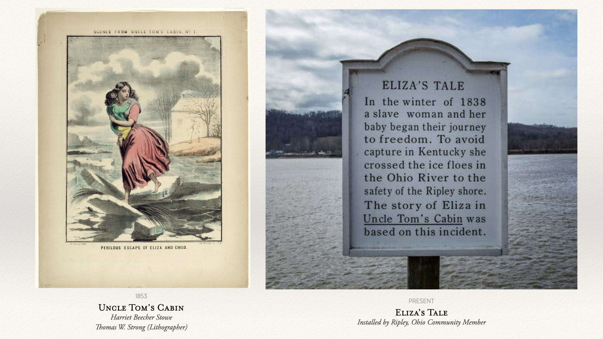
Left: Perilous Escape of Eliza and Child, Thomas W. Strong, 1853. Right: Eliza's Tale, Ripley, Ohio, present day.
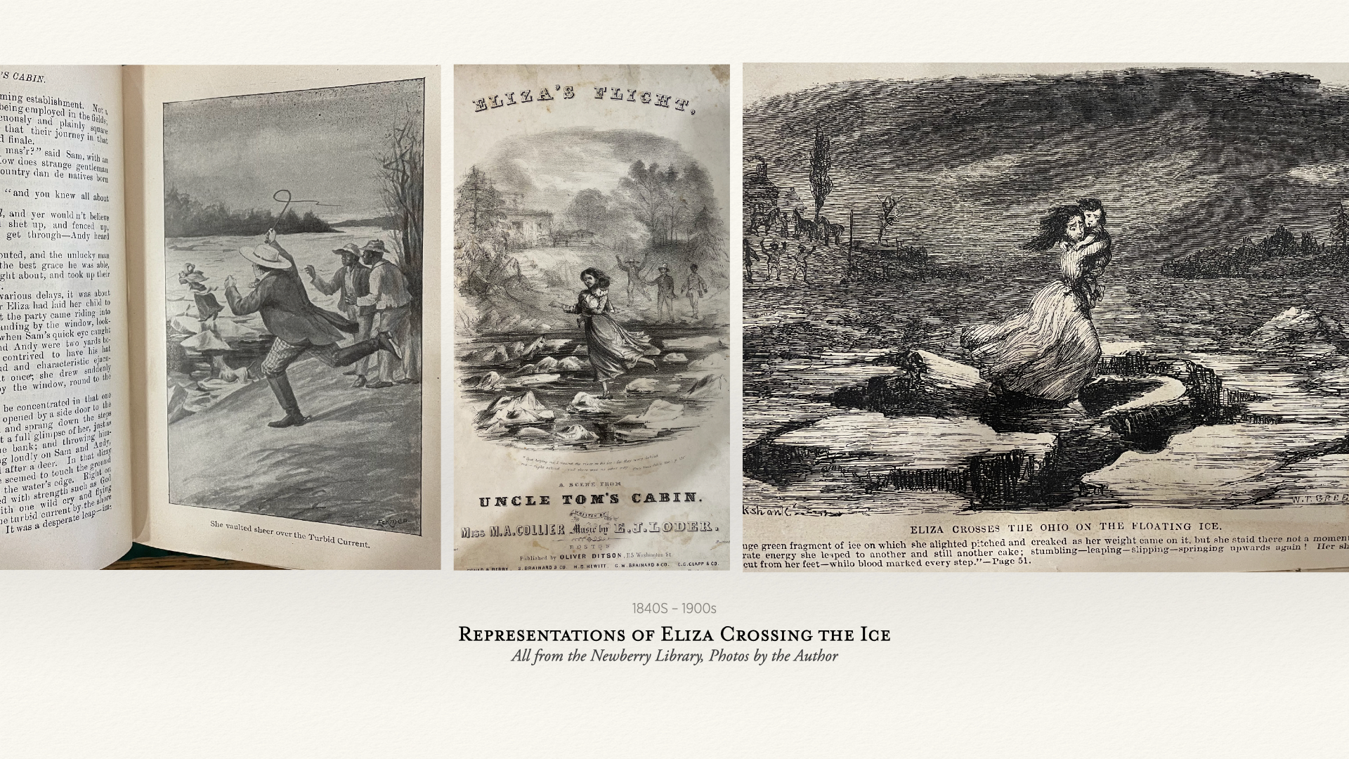
Representations of Eliza Crossing the Ice, 1840s–1900s. All from the Newberry Library. Photos by the author.
These three images place the viewer in three different positions along Eliza's route. In the first, we stand on the Kentucky shore—watching her flee across the Ohio River. From this vantage point, we are on the same side as the kidnappers pursuing her. In the second, we have crossed to the Ohio shore and face her as she comes toward us, her pursuers now visible on the far bank behind her. In the third image, we are standing in the river itself—in the middle, in the between—watching her crash through the ice with her child in her arms. Each image shifts the moral weight of the scene by shifting where we stand.
Moving into the animation, questions are posed about how to represent Eliza's experience so that her agency, ingenuity, and courage are at the forefront of the narrative — rather than a hackneyed image of white femininity.
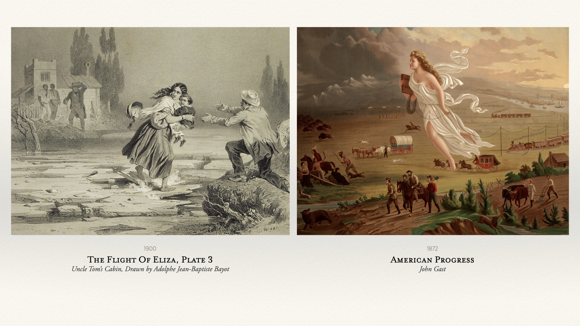
Left: The Flight of Eliza, Plate 3, Adolphe Jean-Baptiste Bayot, 1900. Right: American Progress, John Gast, 1872.
John Gast's American Progress is strikingly familiar with contemporary depictions of Eliza Harris. The physical similarities are hard to ignore — flowing hair, billowing dress, determined profile, both depicting a winged angel fleeing oppression and leading the way for enlightenment. As a light-skinned Black woman, Eliza's character formed a sympathetic image of motherly love and bravery — another difficult reason why this story, more than others perhaps, caught the abolitionist imagination of America at the time.
I begin each drawing by transcribing the source material myself. This may seem like a strange act — I already have the text in digital form, so why recreate the words in a document? But in my designer's mind, I need to retrace the words slowly to allow for discovery. This act of deliberately typing allows me to see other aspects of the text, and is an important step in immersing myself in the journey.
Levi Coffin's autobiography provided the second-hand account for Eliza's well-known escape from Kentucky to Ripley, Ohio, where she was received and sheltered by the townspeople, including the Reverend John Rankin, a notable abolitionist.
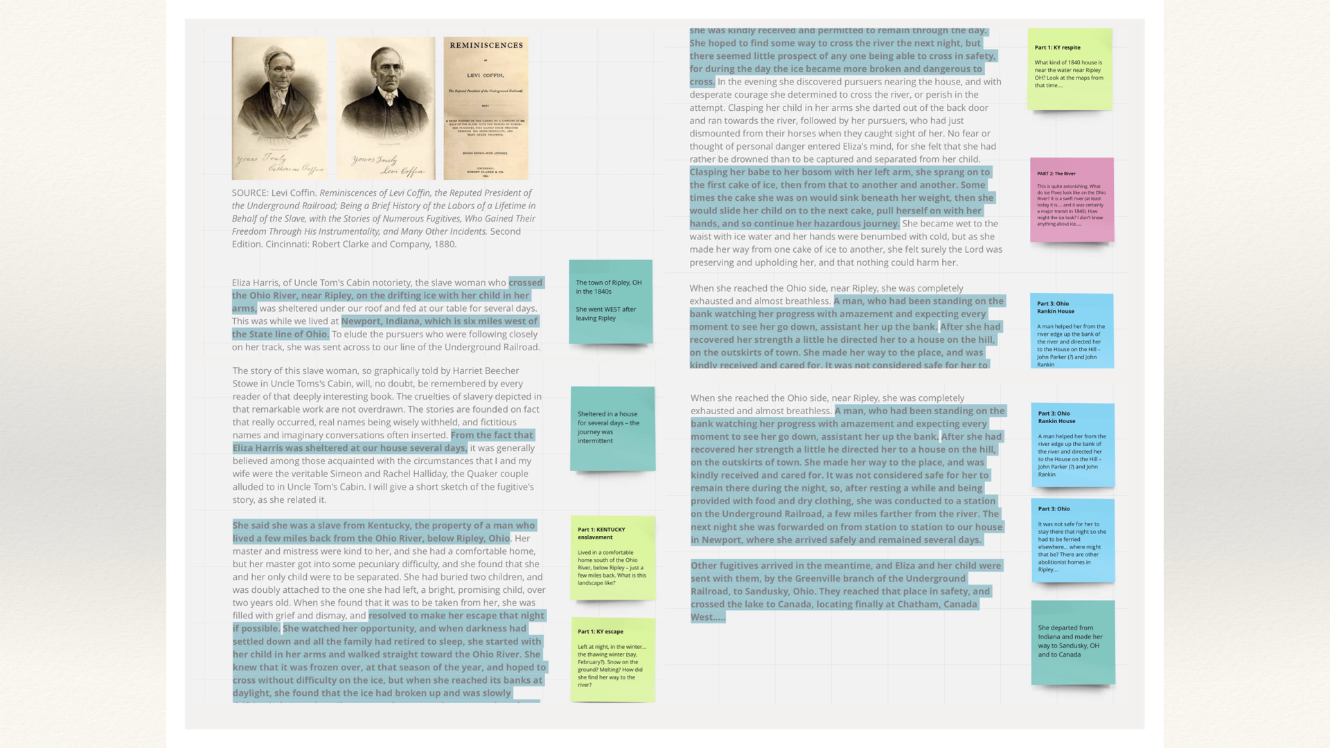
Levi Coffin, Reminiscences, 1880. Annotated and color-coded by spatial phase of Eliza's journey.
After slowly immersing myself in the words, I translate the story into a sketch — thinking of the journey as a series of places, stops, interactions — to visualize the unique spatial sequences that formed her Underground Railroad. The text becomes territory. The words become a map.
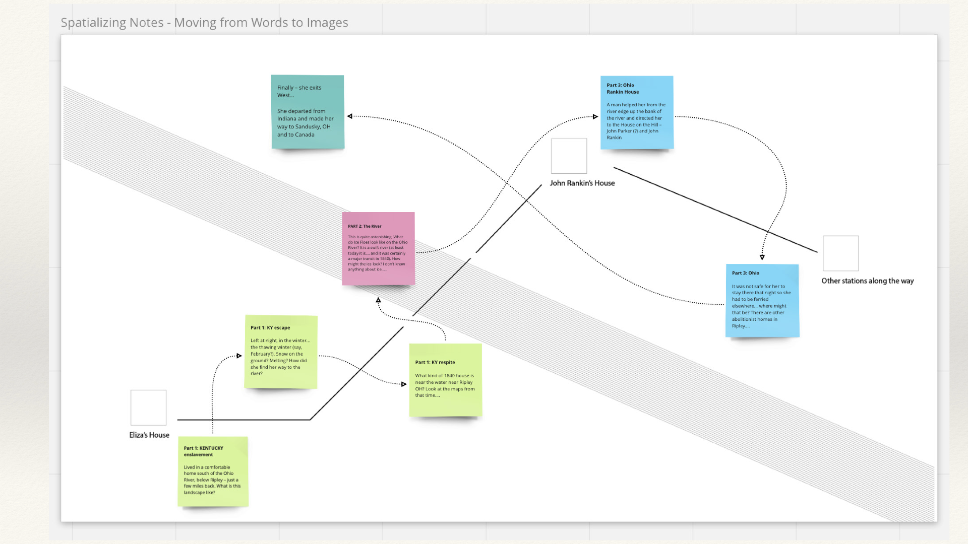
Spatializing Notes — Moving from Words to Images. Presented at Stanford University's David Rumsey Map Library.
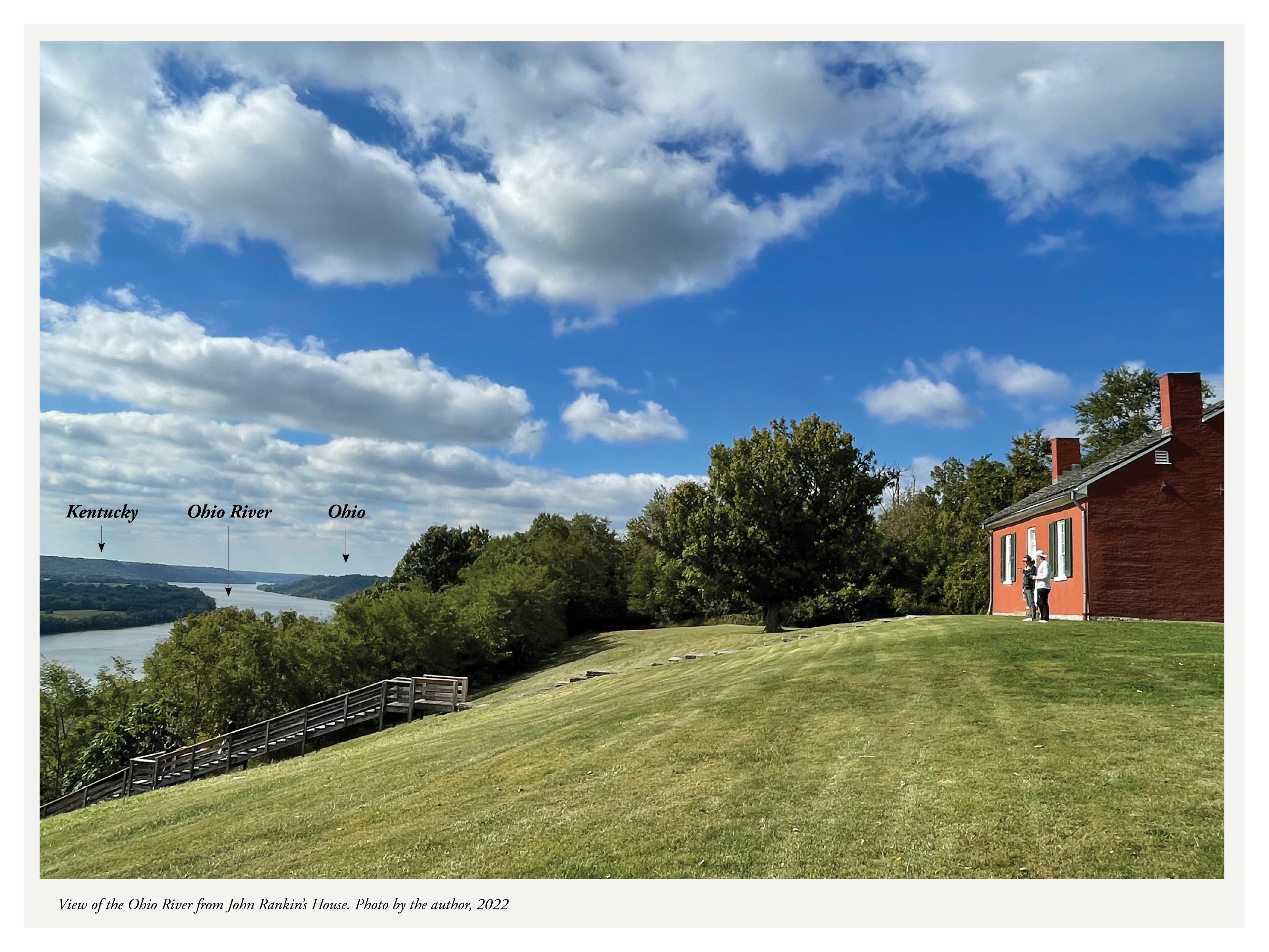
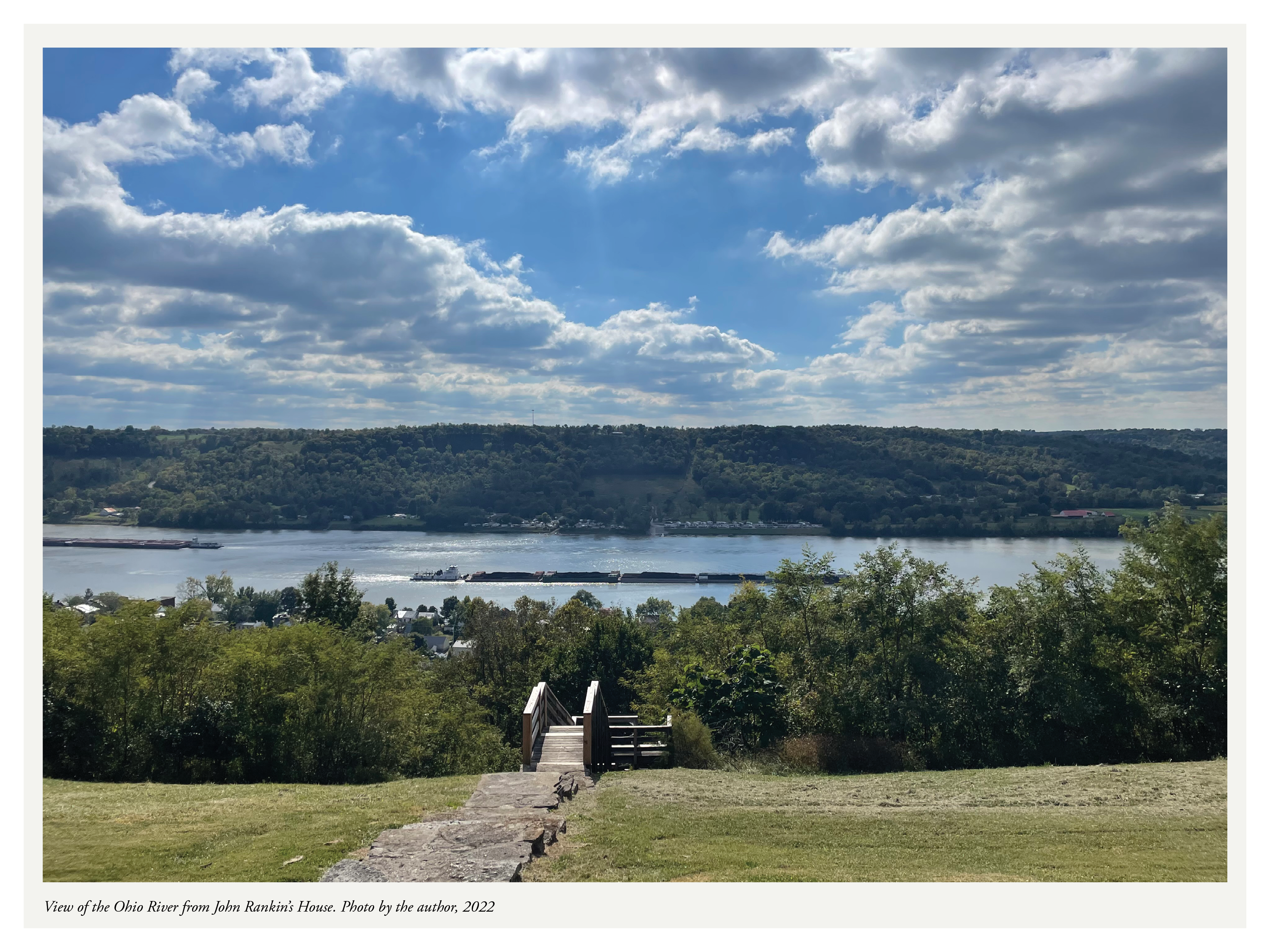
The first stop on the National Parks Service Underground Railroad Tour of Ripley, Ohio begins at the John Rankin House National Historic Landmark, located on the highest elevation in town. Built in 1829, the house sits in a wide clearing on a bluff overlooking the Ohio River. Standing next to the home of one of the most well-known anti-slavery activists of the 19th century, visitors survey the breadth of the river, the dissected bluffs of the Cumberland Plateau, and the rolling hills of the Kentucky Bluegrass beyond.
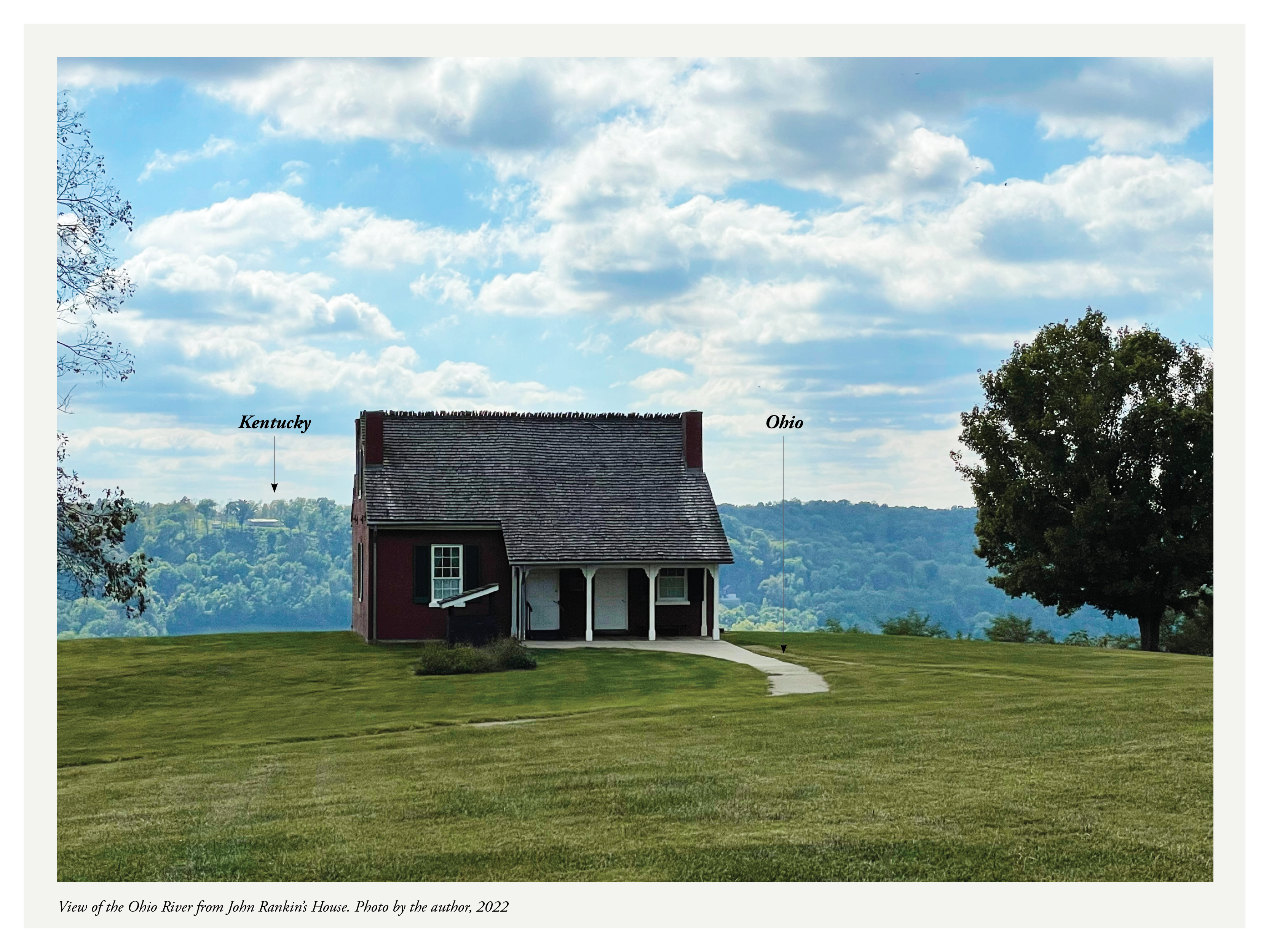
View of the Ohio River from John Rankin's House. Photo by the author, 2022.
View of the Ohio River from John Rankin's House. Photo by the author, 2022.
For more than 40 years, the Reverend John Rankin and his family conducted over 2,000 individuals escaping slavery by way of this parsonage. The lights from Rankin's house acted as a lantern—this pinprick of light providing both signal and navigation for the enslaved men and women who would cross the dark Ohio River from Kentucky to Ohio. From the river banks, fugitives would make their way through the town to a staircase known as the "100 Steps to Freedom," to Rankin's house on "Liberty Hill."
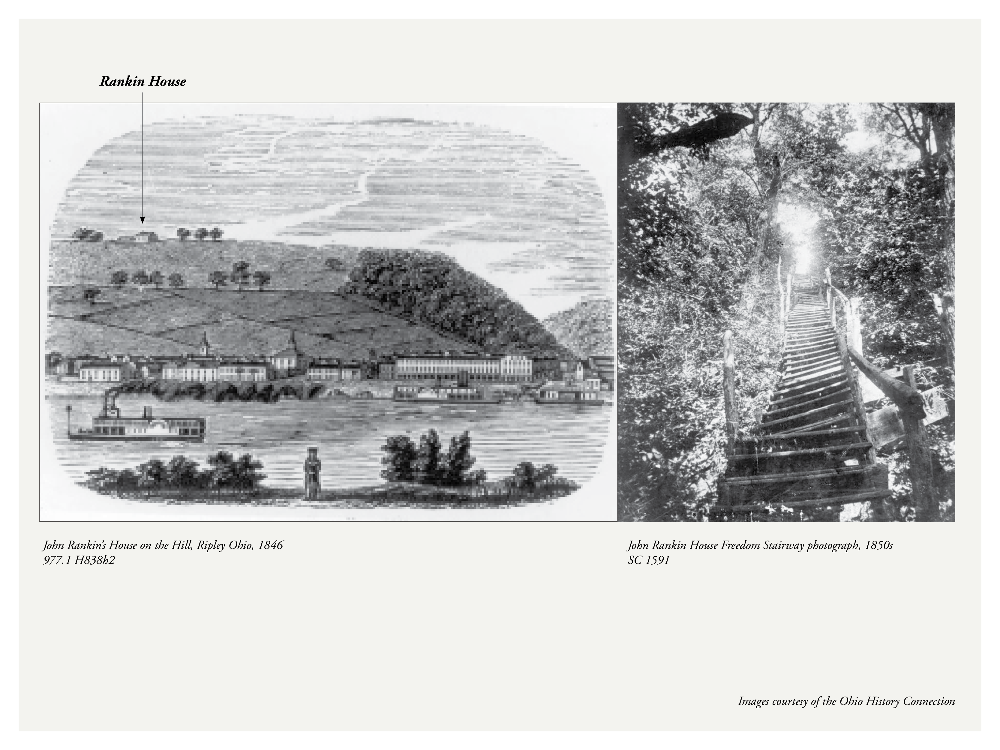
Left: John Rankin's House on the Hill, Ripley Ohio, 1846. Ohio History Connection, 977.1 H838h2. Right: John Rankin House Freedom Stairway, 1850s. Ohio History Connection, SC 1591.
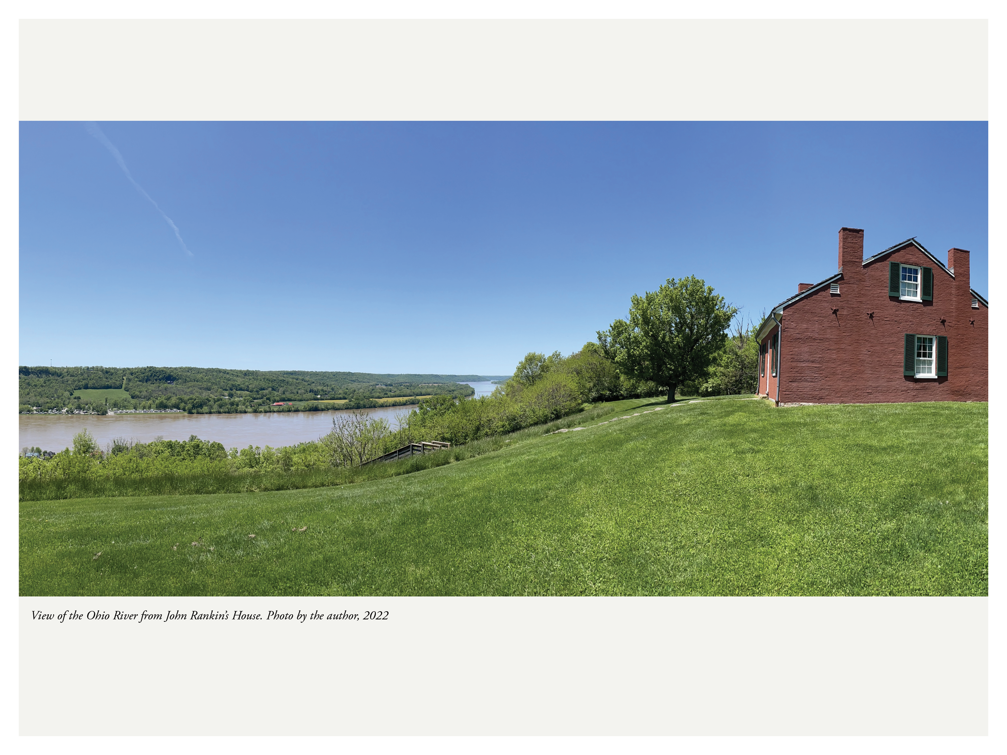
View of the Ohio River from John Rankin's House. Photo by the author, 2022.
Standing at the beautifully restored Rankin house, surrounded by a pristinely mown field and gazing at the landscape beyond, one cannot help but feel deeply reassured by the idyllic vista. The oversight and organization of home and landscape, township, river, and history, is carefully crafted through National Parks Service management and interpretation. It's a highly organized way to begin learning about a terrifying and difficult history.
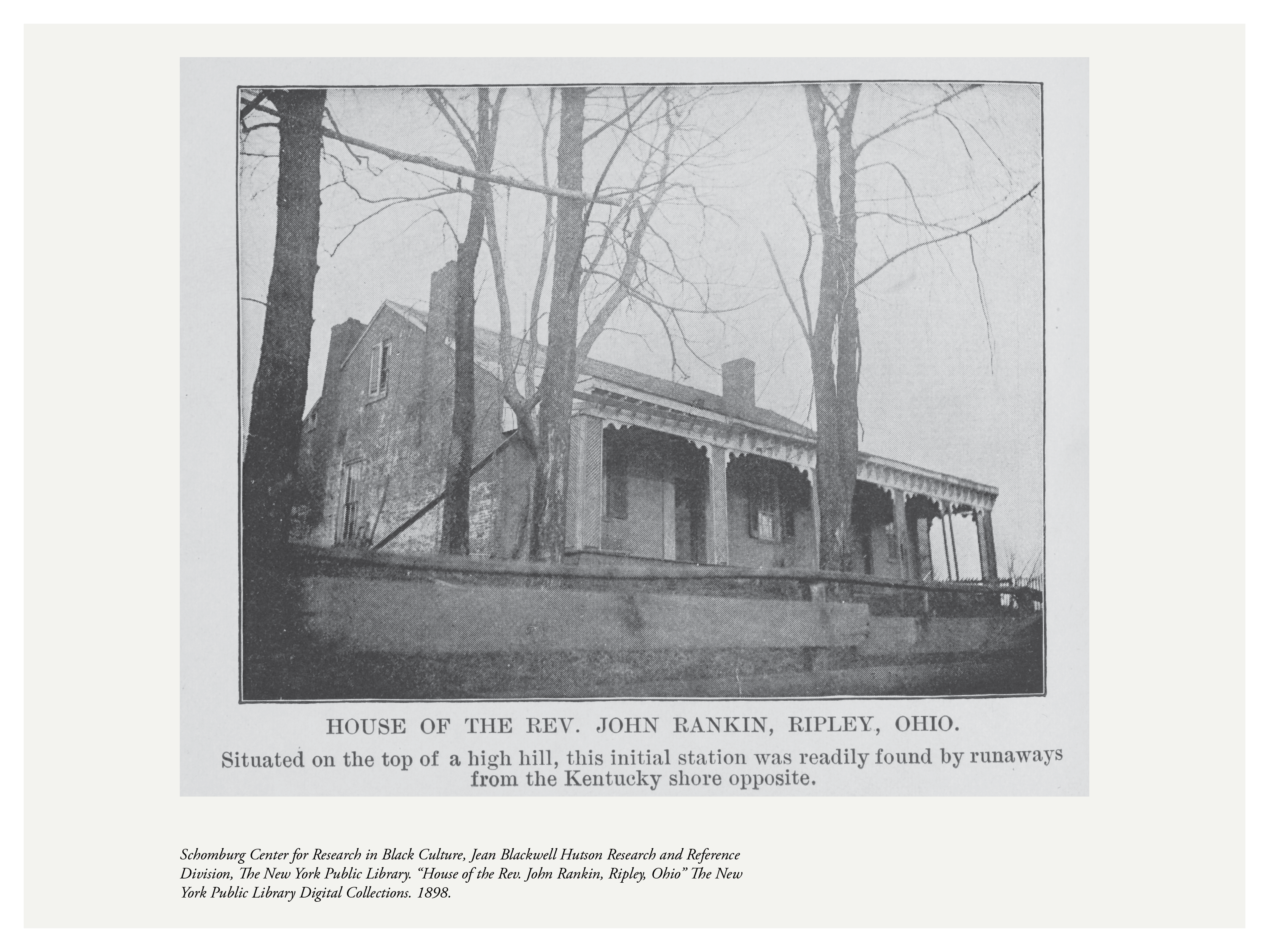
House of the Rev. John Rankin, Ripley, Ohio, 1898. Schomburg Center for Research in Black Culture, New York Public Library Digital Collections.
We often learn about the Underground Railroad from the point of view of the people, states and laws that abolished slavery—and the tour of Ripley is no different. Beginning at the Rankin house, our education starts through the eyes of a watchful conductor, a well-known and respected community member, church leader and national celebrity. This starting point positions visitors squarely as land-owning abolitionists, ready to receive fugitives—or deflect kidnappers—from the comfort of our land, our house, our view.
View of the Ohio River from John Rankin's House. Photo by the author, 2022.
Suppose we reorder the spatial sequence of the tour—and instead of beginning on the bluff, we start on the banks of the Ohio River, at the bottom of the freedom stair, at the edge of downtown Ripley. From this perspective, the river dominates our field of vision. It is from this observant and careful lookout that John Parker, a Black man who purchased his own freedom from enslavement, scanned the river to bring fugitives from the water out of slavery—sometimes even crossing into Kentucky to help people escape.
As landscape historian Cheryl Janifer La Roche has described, the two homes of Rankin and Parker "exemplify how the geography of resistance operated—Rankin as the unconcealed White abolitionist and beacon of hope and freedom high at the end of the freedom stairway, Parker as the silent African American operator at the more dangerous water's edge providing immediate access to that freedom."
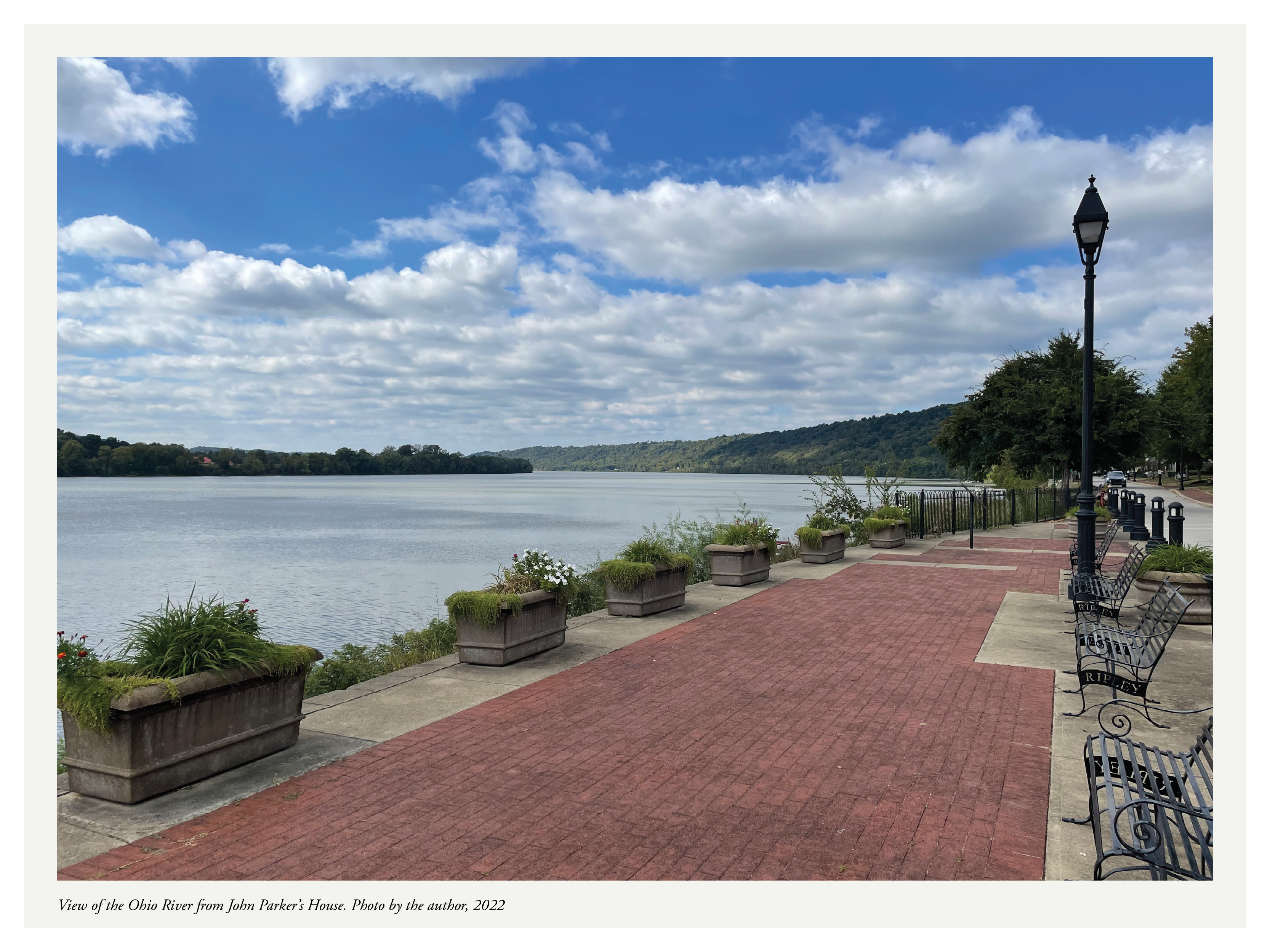
View of the Ohio River from John Parker's House. Photo by the author, 2022.
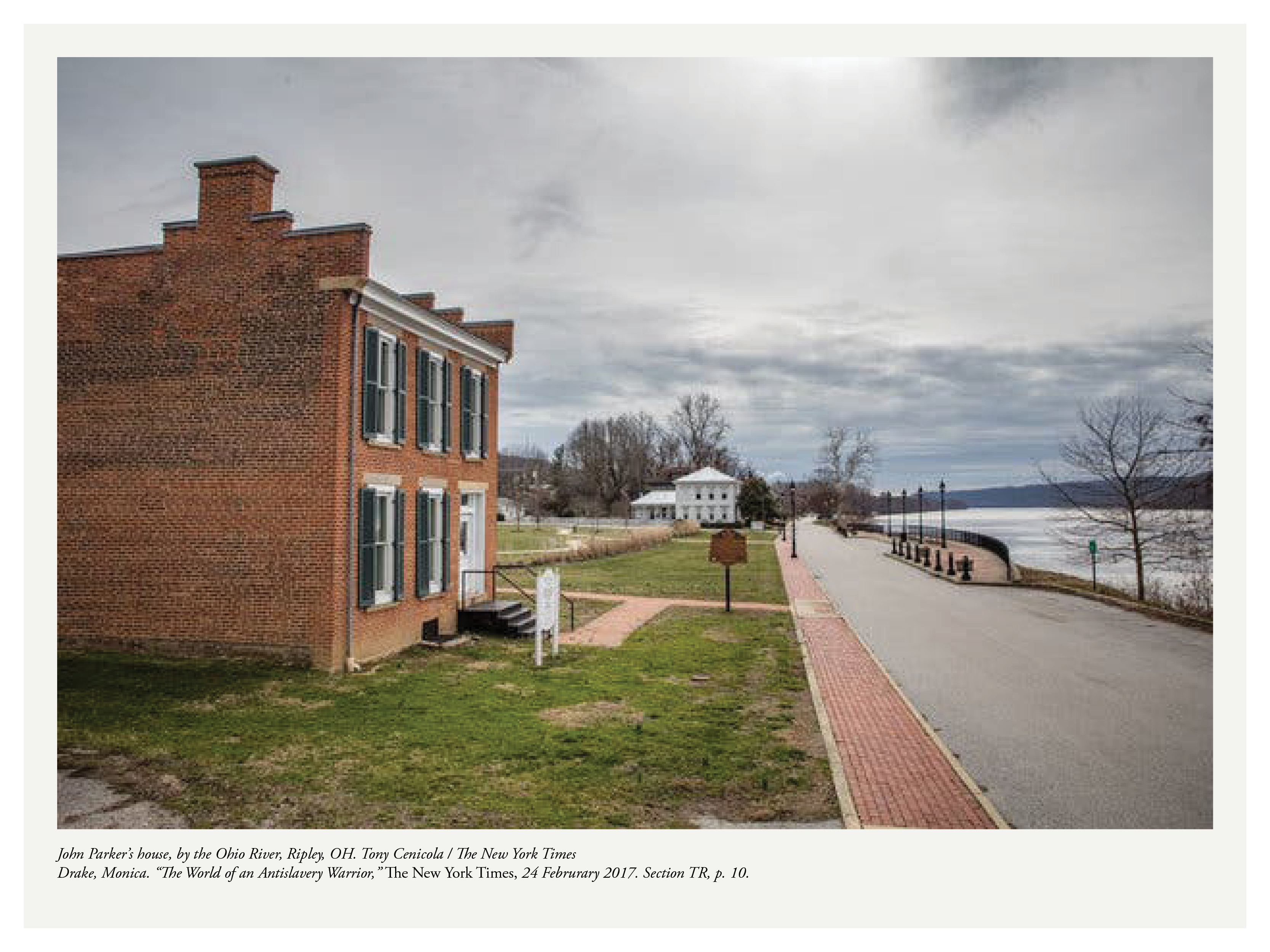
John Parker's house, by the Ohio River, Ripley, Ohio. Tony Cenicola / The New York Times, 2017.
Suppose we reorder the spatial sequence yet again—and instead begin the tour in Kentucky, on the banks of the Ohio River looking north, gazing at Ripley from the shores of a state that permitted the enslavement of human beings. The eyes of our beholder is no longer that of a white, land-owning, unconcealed abolitionist, but that of a watchful, careful woman who enacted her own freedom the night before. Eliza Harris holds her baby in her arms, moving quickly out of view of her pursuers, waiting for the right time to begin her escape.
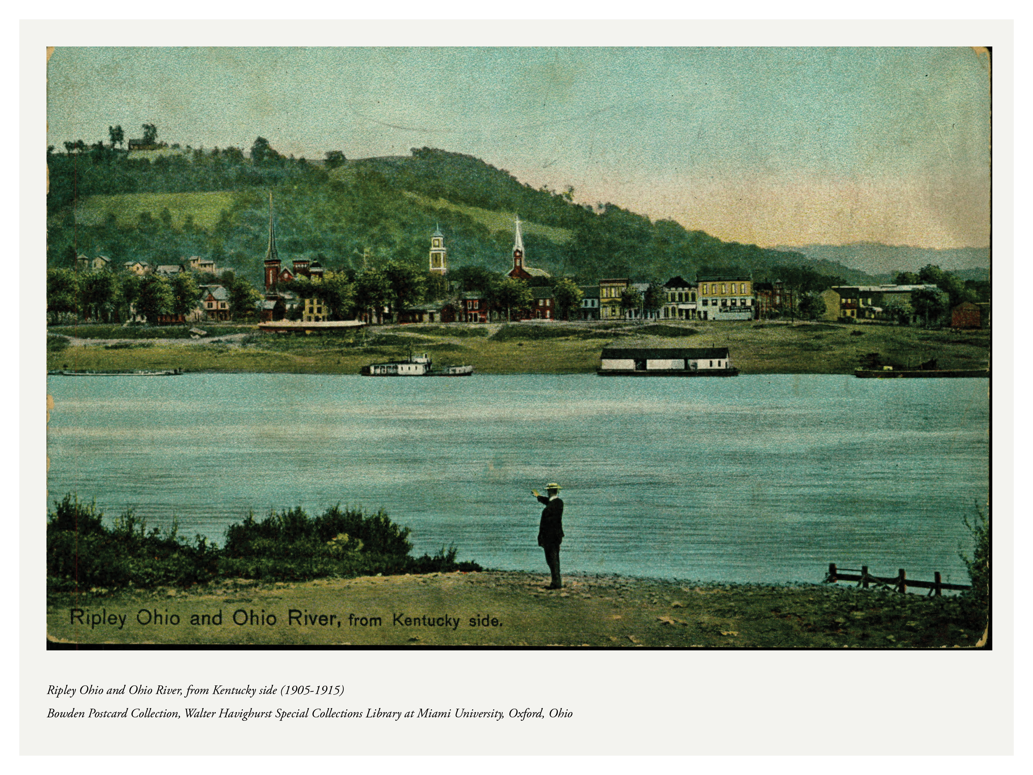
Ripley Ohio and Ohio River, from Kentucky side, 1905–1915. Bowden Postcard Collection, Walter Havighurst Special Collections Library, Miami University, Oxford, Ohio.
Hartman, Saidiya. Wayward Lives, Beautiful Experiments. Norton, 2019. Publisher →
Coffin, Levi. Reminiscences of Levi Coffin. Robert Clarke and Company, 1880. Project Gutenberg →
David Rumsey Map Collection. Historic maps of Ohio and Kentucky, 1800–1870. davidrumsey.com →
John Rankin House, Ripley, Ohio. Ohio History Connection. ohiohistory.org →
Stowe, Harriet Beecher. Uncle Tom's Cabin. 1852. Project Gutenberg →
The Small House of Uncle Thomas. The King and I. Rodgers and Hammerstein, 1951. Watch →
Gast, John. American Progress. 1872. Autry Museum of the American West. View →
Eliza Harris illustrations, 1840s–1900s. Newberry Library, Chicago. newberry.org →
Tap outside to close