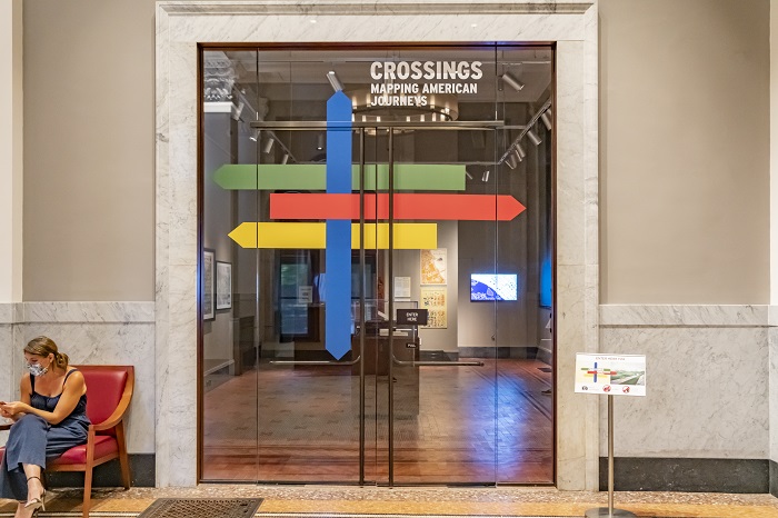
Entrance to Crossings: Mapping American Journeys, Trienens Galleries, The Newberry Library, Chicago, 2022. The animation is visible behind the glass.
This visualization was made for the Crossings: Mapping American Journeys exhibition at the Newberry Library. Using Wilbur Siebert's map of the Underground Railroad and the personal memoirs of three survivors—Edward Moxley, Eliza Harris, and William Wells Brown—it traces their journeys from enslavement to liberation across the same landscape simultaneously traversed by railroad, canal, and stagecoach. Months of archival research, GIS mapping, and architectural drawing were organized into sixty seconds of film.
Entrance to Crossings: Mapping American Journeys, Trienens Galleries, The Newberry Library, Chicago, 2022. The animation is visible behind the glass.
Animation still: Eliza Harris arrives in Ripley, Ohio. Mapping the Underground Railroad: Landscapes of Defiance and Ingenuity, 2022.
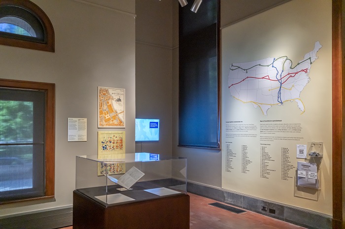
Crossings installation view showing the Underground Railroad wall map and exhibition display. Animation screen visible at center. Trienens Galleries, Newberry Library, 2022.
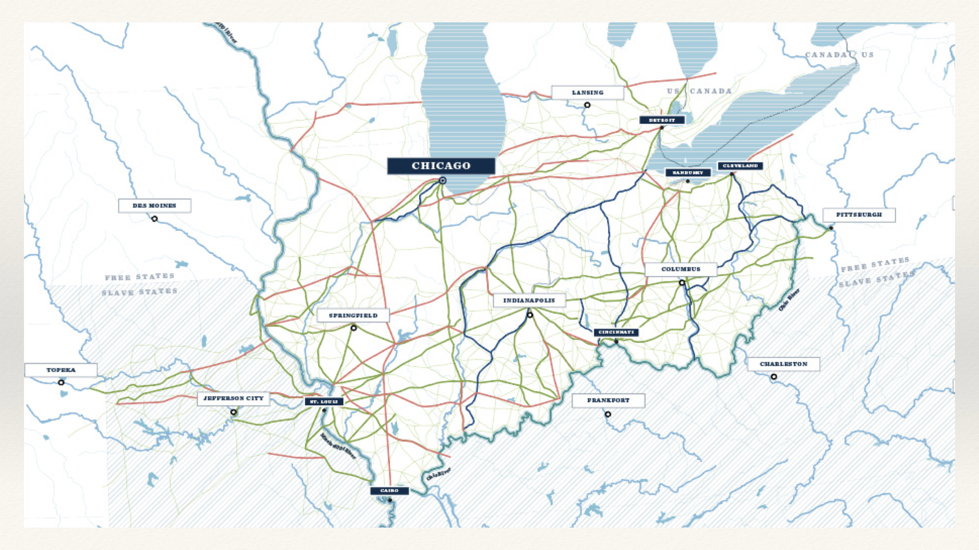
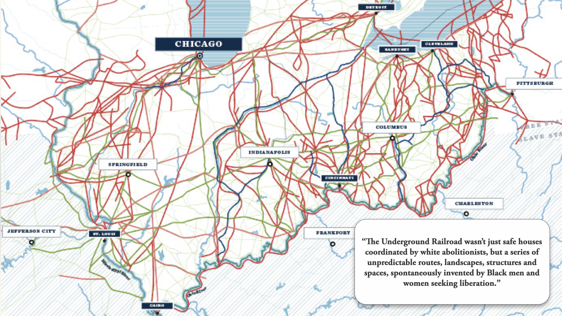
The exhibition began with two historic maps: Colton's Guide through Ohio, Michigan, Indiana, Illinois, Missouri, Wisconsin & Iowa, which documented the physical infrastructure of the 1840s—railroads, canals, stagecoach routes—and Wilbur Siebert's map of the Underground Railroad, drawn in the late 1890s from decades of interviews with Black men and women who had fled slavery through Ohio, and with the white landowners who had sheltered them. The conceptual premise of Crossings was to hold both maps simultaneously: to ask what it meant to lay the infrastructure of commerce and mobility against the clandestine geography of liberation.
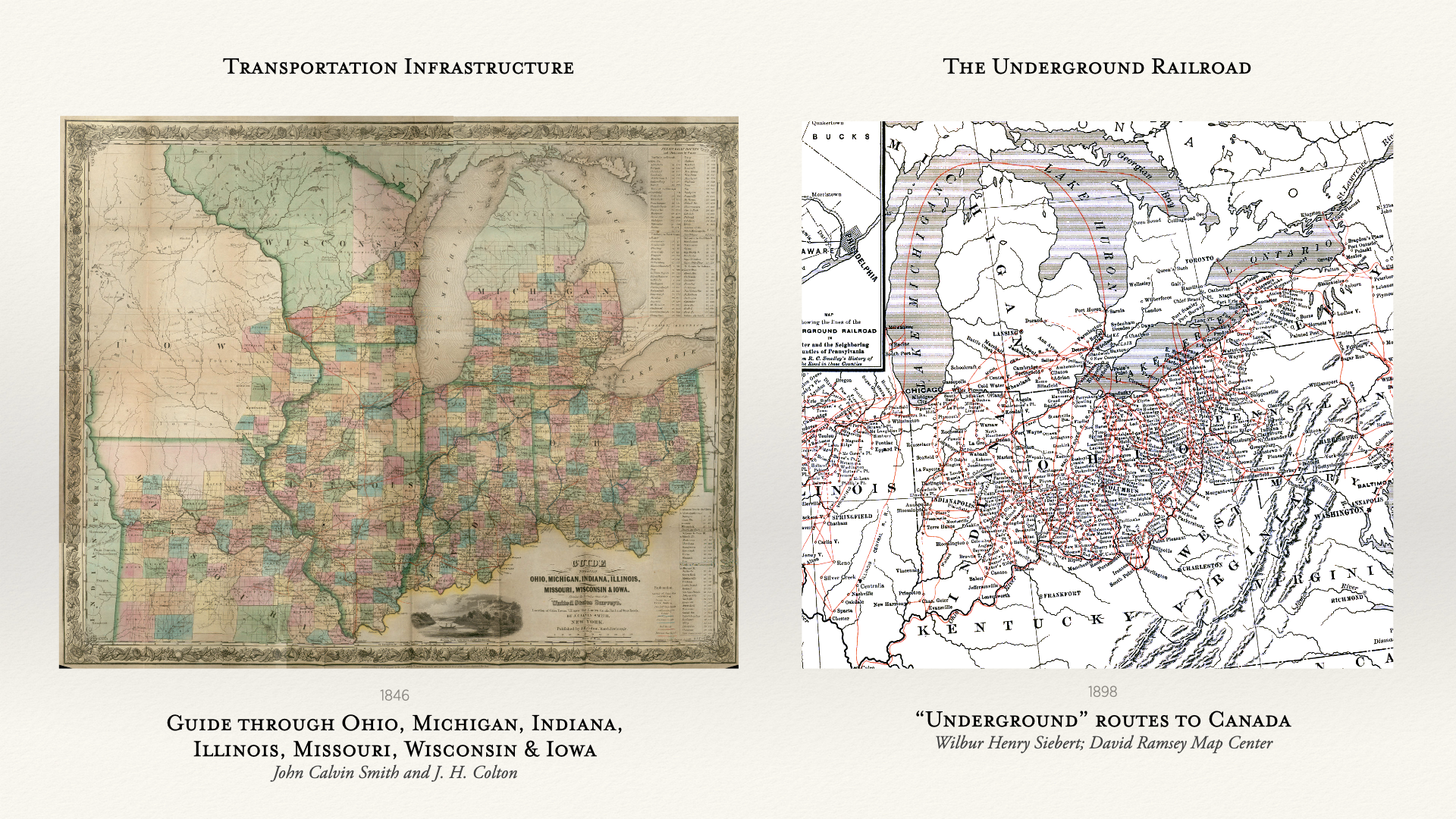
Left: Guide through Ohio, Michigan, Indiana, Illinois, Missouri, Wisconsin & Iowa, John Calvin Smith and J. H. Colton, 1846. Right: "Underground" routes to Canada, Wilbur Henry Siebert, 1898. David Rumsey Map Center.
My first task was to translate these historic maps into spatial data using GIS—tracing the canals, railroad lines, and state boundaries from the Colton map, and then doing the same for the routes, nodes, and counties of the Siebert map. This process is slow and immersive. To digitize a map is to inhabit the mind of the cartographer who made it—to understand not only what was recorded, but what was omitted, generalized, or assumed. In the case of Siebert's map, what emerged from that inhabiting became the central problem of the work.
Siebert's 1898 Underground Railroad map translated into GIS—routes, nodes, and counties redrawn as spatial data.
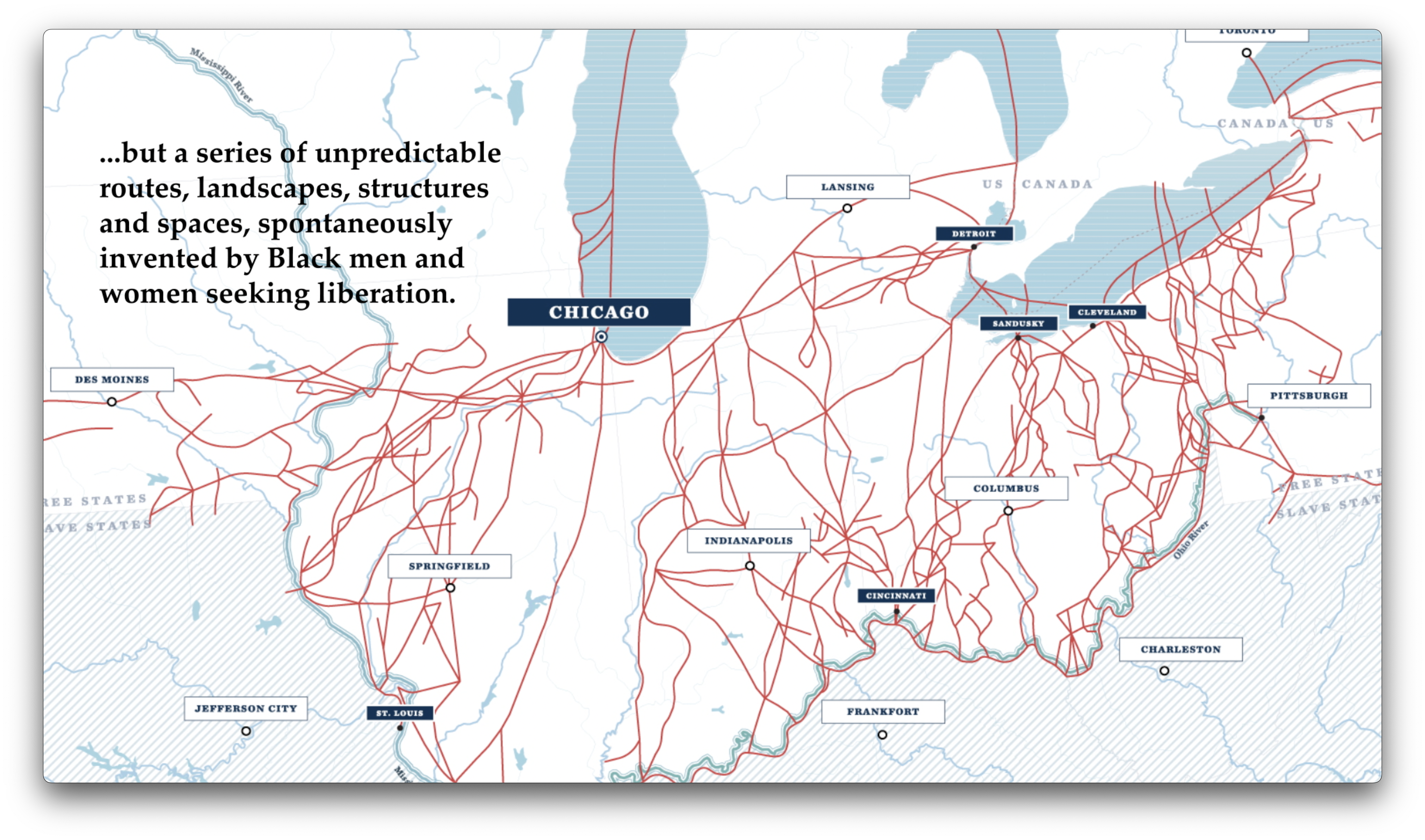
Siebert's map is compelling and meticulously documented—the product of a career spent in painstaking research. But its routes privilege white abolitionist homes and stations, the structures that still stand today, as the primary nodes of the Underground Railroad. Siebert's network is organized around property and testimony filtered through his own position as a white academic in the 1890s. Reading it carefully, one begins to notice the gaps: the routes between stations, the places where people found shelter outside of documented abolitionist networks, the stories that left no record at all. The map tells us a great deal. It also tells us what it cannot tell us.
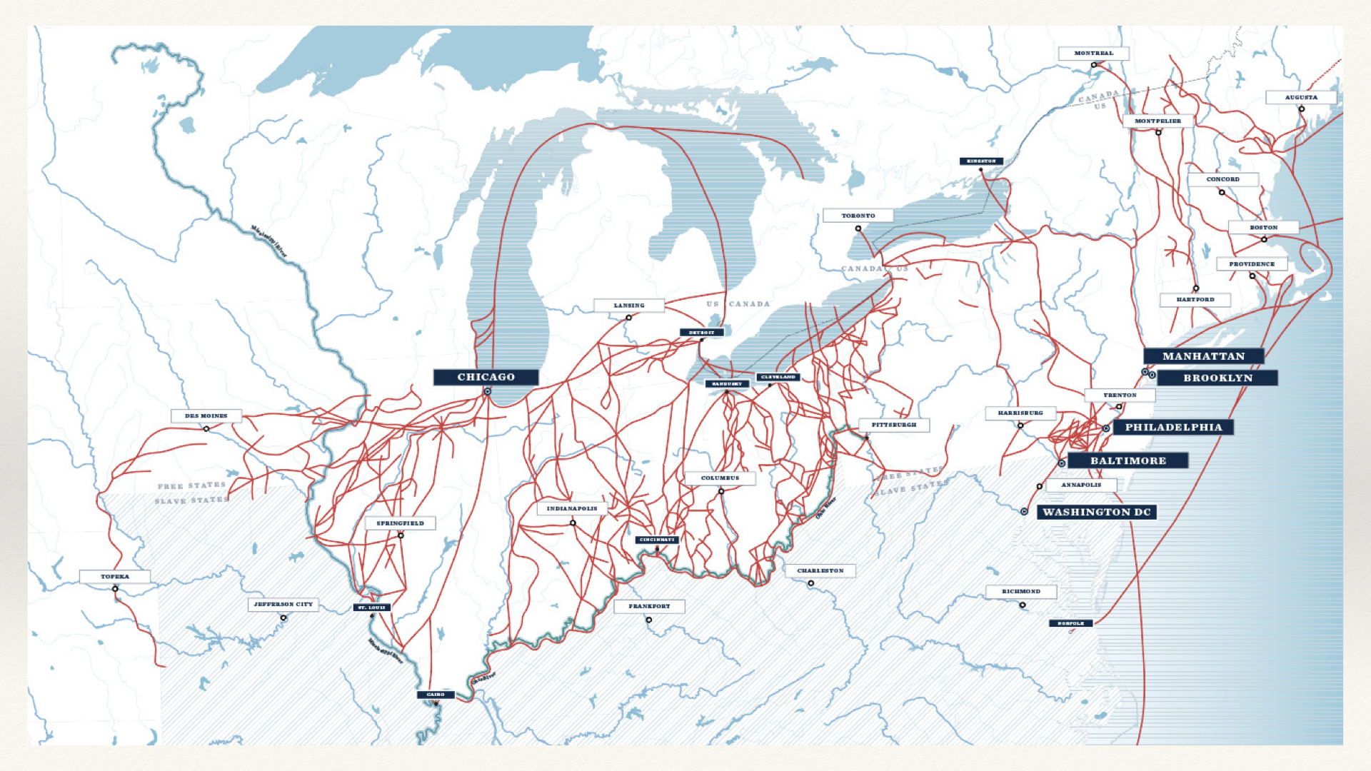
Transportation infrastructure and Underground Railroad routes overlaid. The conceptual premise of Crossings: to hold both maps simultaneously.
I begin every journey by transcribing the source material myself. This may seem like a strange act—the text is already in digital form, so why trace the words again in a document? In my designer's mind, I need to retrace the words slowly to allow for discovery. The act of deliberate retyping produces a different quality of attention—a slowing down that allows other aspects of the text to become visible. After transcription, I draw the journey as a series of spaces and stops—not stations necessarily, but the places and moments where the story needs to follow. The text becomes territory. The words become a map.
Siebert's 1898 Underground Railroad map translated into GIS—routes, nodes, and counties redrawn as spatial data.
From this spatial sketch, the architectural and landscape research begins: the structures at Ripley, the topography of the river crossings, the organization of agricultural land in Kentucky. Each site was modeled from historic maps, photographs, land records, and National Parks Service documentation. Where the record ran out—and it runs out often—the imagination was enlisted, carefully, with its limits acknowledged. History asks us to use our imagination to fill certain gaps. The obligation is to be honest about where the gap is, and where the filling begins.
Selecting which narratives to include in the visualization required sustained attention to whose voice is present in the archival record—and whose is shaped or filtered by the conditions under which it was collected. Three stories were chosen with this in mind.
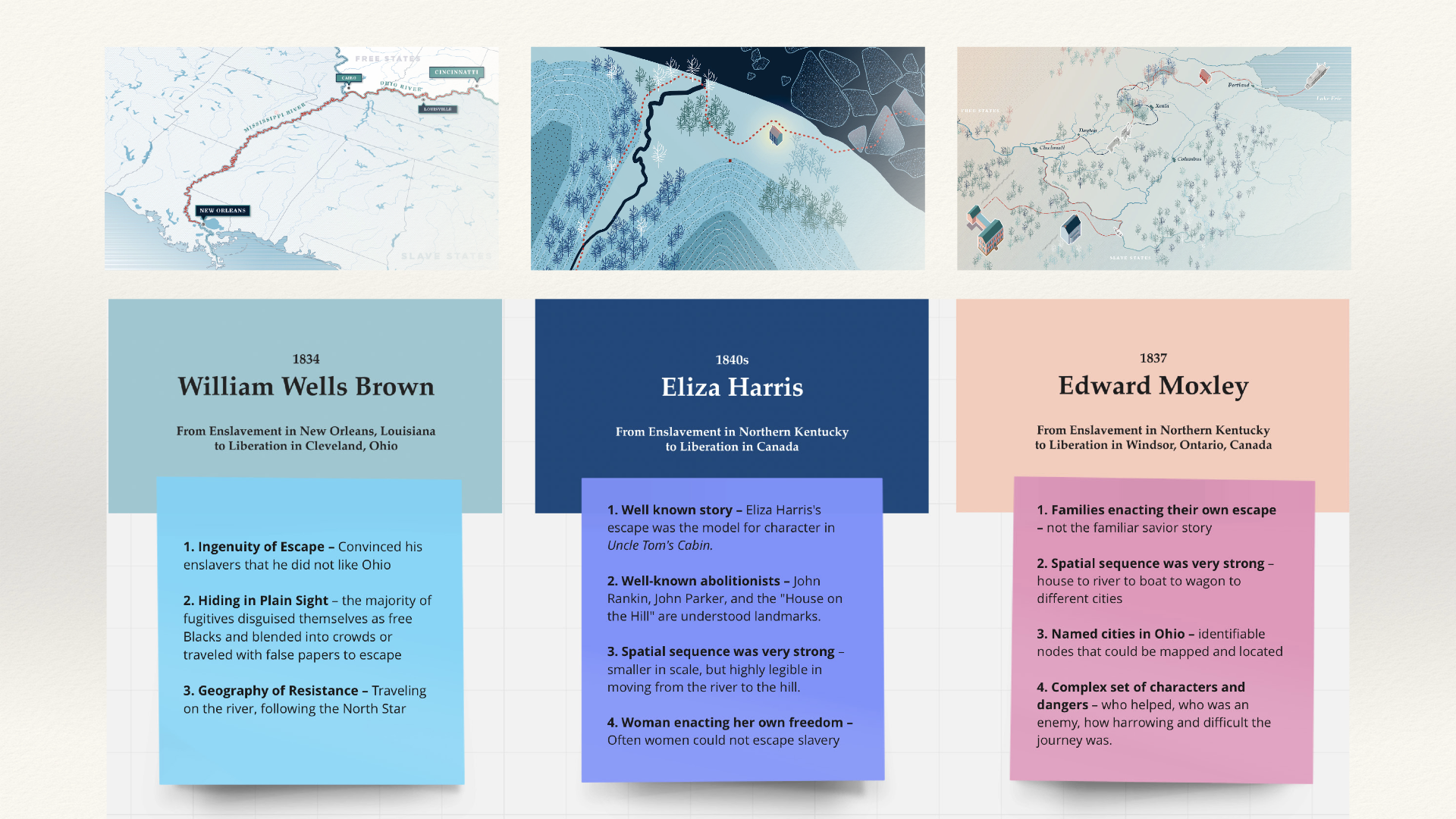
The three narratives in the visualization: William Wells Brown (1834), Eliza Harris (1840s), Edward Moxley (1837). From the author's lecture, Chicago Map Society, 2022.
William Wells Brown narrated his own escape from enslavement in his own published words—an account in which his voice is relatively direct and unmediated.
Eliza Harris is one of the most widely reproduced stories in the abolitionist record—her escape across the frozen Ohio River documented by Levi Coffin and dramatically rendered in Uncle Tom's Cabin. But her story was primarily collected and circulated by white abolitionists, and the visual representations it generated consistently depicted her as a white woman. The representational traps around her story are numerous and well-worn.
Edward Moxley was interviewed by Siebert, his testimony preserved in the Siebert Archive at the Ohio History Connection. Reading the Siebert interviews, one learns to read between the lines—to detect the invisible questions that shaped the answers, the pauses where a different kind of pressure was being applied.
These three stories were not chosen because they are representative. They were chosen because, together, they illuminate the spectrum of the archival record—its extraordinary richness, its deep biases, and the imaginative and scholarly work required to engage it honestly.
Crossings: Mapping American Journeys. The Newberry Library, Chicago, 2022. Exhibition page →
Maps as Heritage: Commemoration and Travel in American Cartography. Newberry Digital Collections. Read →
United States Expansion, Migrants, and Transportation Technologies, ca. 1810–1930. Newberry Digital Collections. Read →
Siebert, Wilbur Henry. The Underground Railroad from Slavery to Freedom. New York: Macmillan, 1898. Ohio History Connection →
Colton, Joseph Hutchins. Colton's Guide through Ohio, Michigan, Indiana, Illinois, Missouri, Wisconsin & Iowa. New York: J. H. Colton, 1854. David Rumsey Map Collection →
Coffin, Levi. Reminiscences of Levi Coffin. Cincinnati: Western Tract Society, 1876. Project Gutenberg →
Brown, William Wells. Narrative of William W. Brown, a Fugitive Slave. Boston: Anti-Slavery Office, 1847. Project Gutenberg →
Moxley, Edward. Interview by Wilbur Siebert. Siebert Papers, Ohio History Connection.