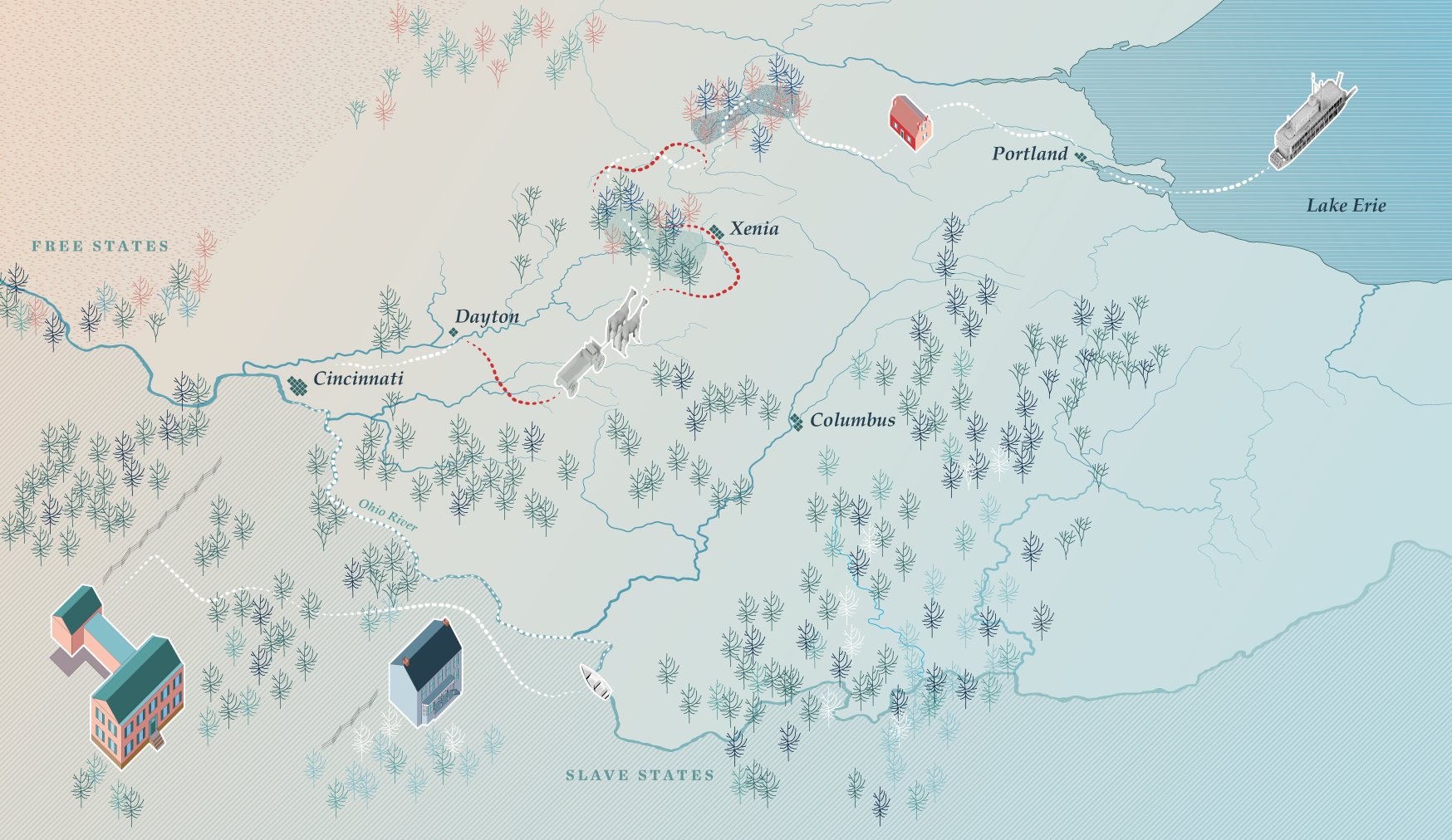
This map traces Edward Moxley's escape from Kentucky to Canada in 1837—told in his own words, fifty-eight years later. Thirteen people left together on a Saturday night in May. Four arrived in Windsor. The white line follows the survivors: river, wagon, woods, farm, wagon again, and a ferry across Lake Erie. The red line traces the pursuit that caught the other nine near Springfield, Ohio—among them Moxley's mother, his brother, and his sister. The map holds both lines. It does not resolve the distance between them.
Was This a Station?
Thompson Library, Ohio State · 2024
Was This a Station?
Columbus Metropolitan Library · 2025
David Rumsey Map Library
Stanford University
[year] Watch →
Imago Mundi
[issue, year] Read →
The white line traces Moxley and the four survivors to Windsor. The red line traces the pursuit that caught nine of the original thirteen near Springfield—among them his mother, his brother, and his sister. Both lines move through the same landscape at the same moment. The map does not resolve the tension between them. It holds it.
Wilbur Henry Siebert was a professor at The Ohio State University who spent decades interviewing men and women who participated in the Underground Railroad in Ohio. In 1898 he published a book containing the first systematized maps of the routes Freedom Seekers used to escape across the Ohio River and into the free North and Canada. His research, questionnaires, letters, written notes, and interviews are digitized and preserved by the Ohio state archives—the first "academic" treatment of the subject, and the source of the interview in which Edward Moxley told his story fifty-eight years after his escape.
Siebert's map borrows its visual language directly from the railroad maps of his moment—the same red lines, the same dense network of hubs and outposts, the same sense of a system one might board and ride to a destination. Henry Gannett's Railroad Systems of the United States, published the same year, is visually nearly identical. The comparison is instructive: Gannett's lines represent physical infrastructure, consistent and material. Siebert's lines represent something else entirely—hundreds of singular, improvised, ephemeral experiences, each one different from the last. The graphic equivalence between them obscures that difference.
Siebert's map has been widely critiqued for prioritizing the accounts of white abolitionist conductors over those of the Freedom Seekers who created the routes. His visual choices compound that problem: a consistent red line at a single weight implies a railroad that was predictable, directional, and stable. The Underground Railroad was none of those things. Networks emerged and faded. Routes were improvised under pressure. The final destination was often undetermined.
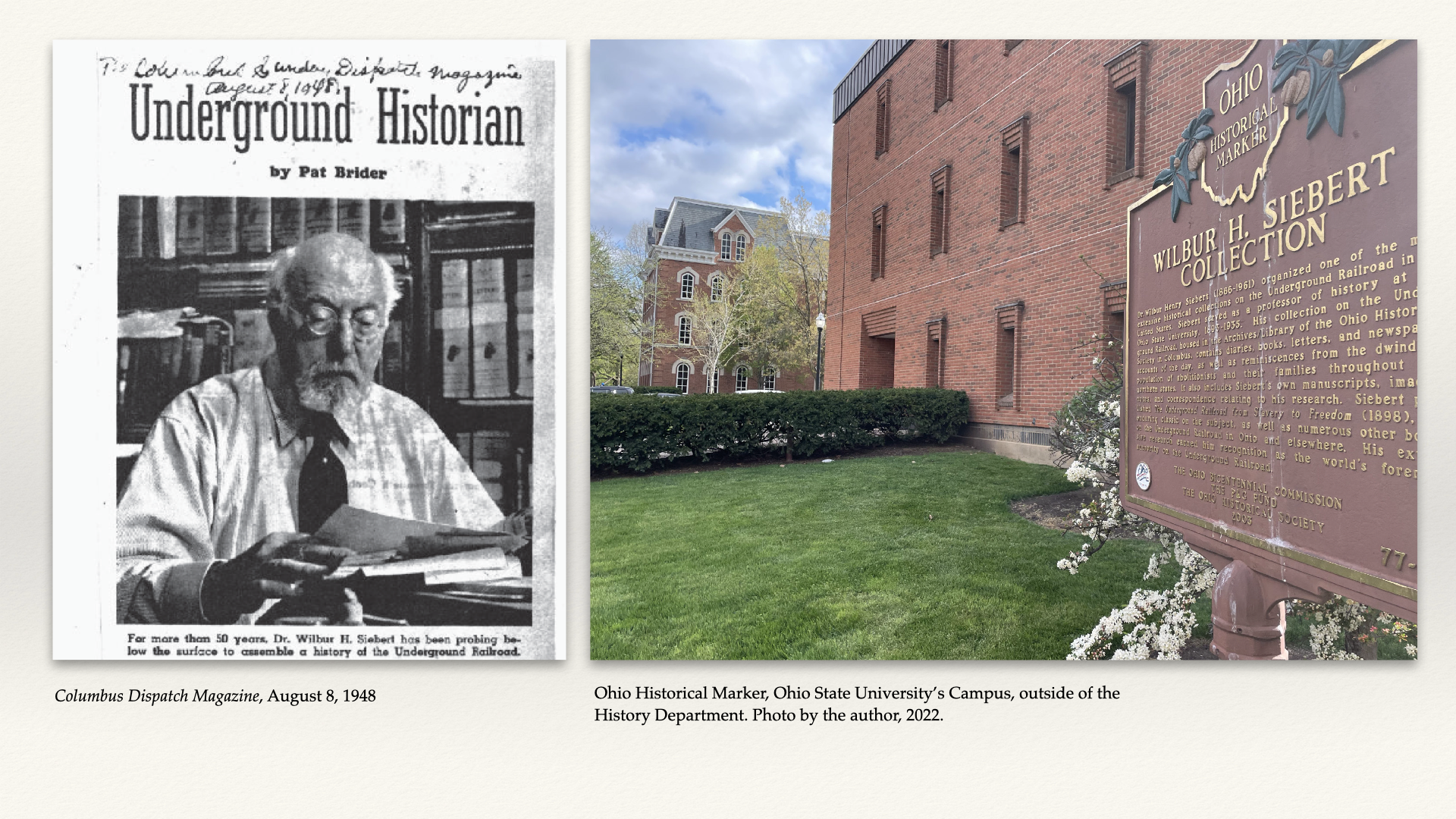
Left: Columbus Dispatch Magazine, August 8, 1948. Right: Ohio Historical Marker, Ohio State University campus, outside of the History Department. Photo by the author, 2022.
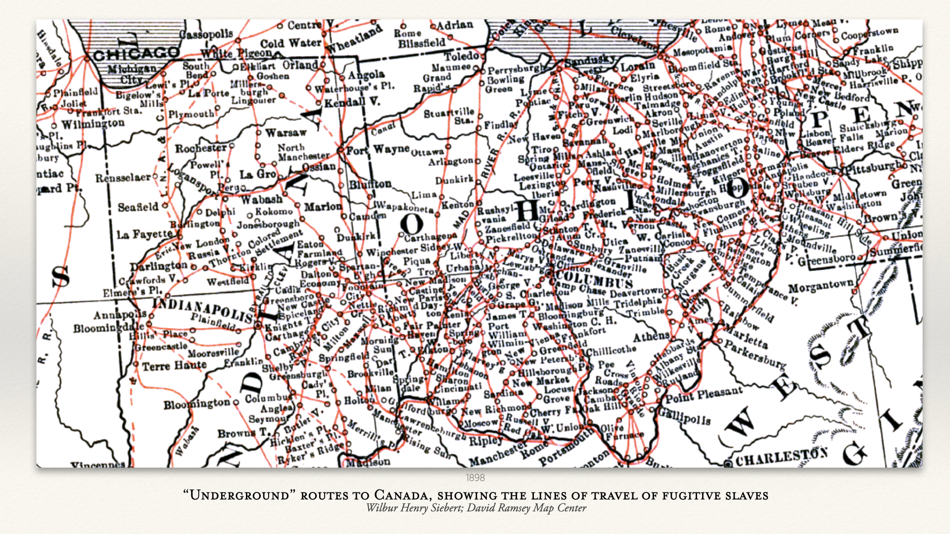
Underground Routes to Canada, Showing the Lines of Travel of Fugitive Slaves. W.H. Siebert, 1898. Ohio History Connection.
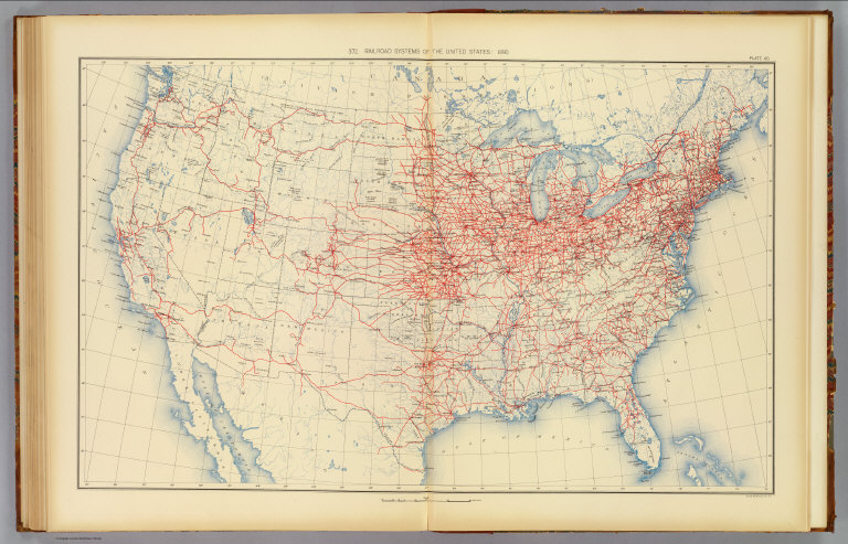
Henry Gannett, Railroad Systems of the United States: 1890. Statistical Atlas of the United States, U.S. Census Office, 1898. David Rumsey Map Collection.
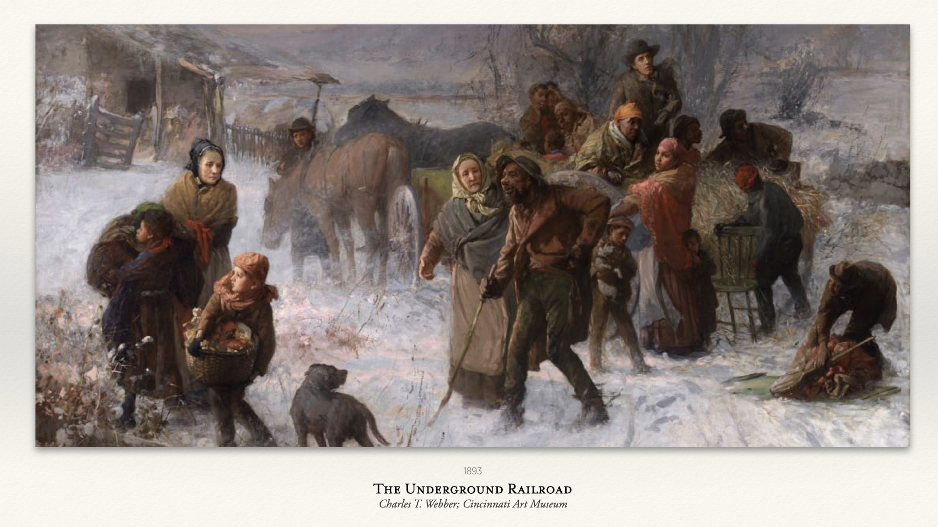
The Underground Railroad, Charles T. Webber, 1893. Cincinnati Art Museum.
Most accounts of Underground Railroad escapes reach us through intermediaries—recorded by conductors, station keepers, and abolitionist historians who witnessed arrivals but not the journeys themselves. The people who escaped are named, if they are named at all, in someone else's voice.
Eliza Harris's crossing of the Ohio River was dramatized by Harriet Beecher Stowe and illustrated dozens of times over the following decades. William Wells Brown wrote his own narrative and went on to become a prominent abolitionist author. Their stories exist in a broad cultural record—depicted, interpreted, reinterpreted. There is a representational history to argue with.
Edward Moxley exists in one place. In 1895, fifty-eight years after his escape, he gave an interview preserved in the Wilbur H. Siebert Collection—the same archive that produced the network map. He was seventy years old. No one illustrated his crossing. No one dramatized his story. The Siebert Collection preserved his voice, and almost nothing else did.
He spoke in the first person plural throughout: we took de boat, we had a wagon, we traveled all that night. That "we" accounts for all thirteen people who left together on a Saturday night in May 1837—before the pursuit fractured them near Springfield.
This was not a spontaneous flight. Moxley's father had already purchased his own freedom and was living in Cincinnati. He had the preparations arranged before his son arrived. When Moxley reached the old homestead that night, he found his mother and the rest of the family already getting ready to leave. "He had preparations all fixed we was to come away dat Saturday night." Moxley never went back.
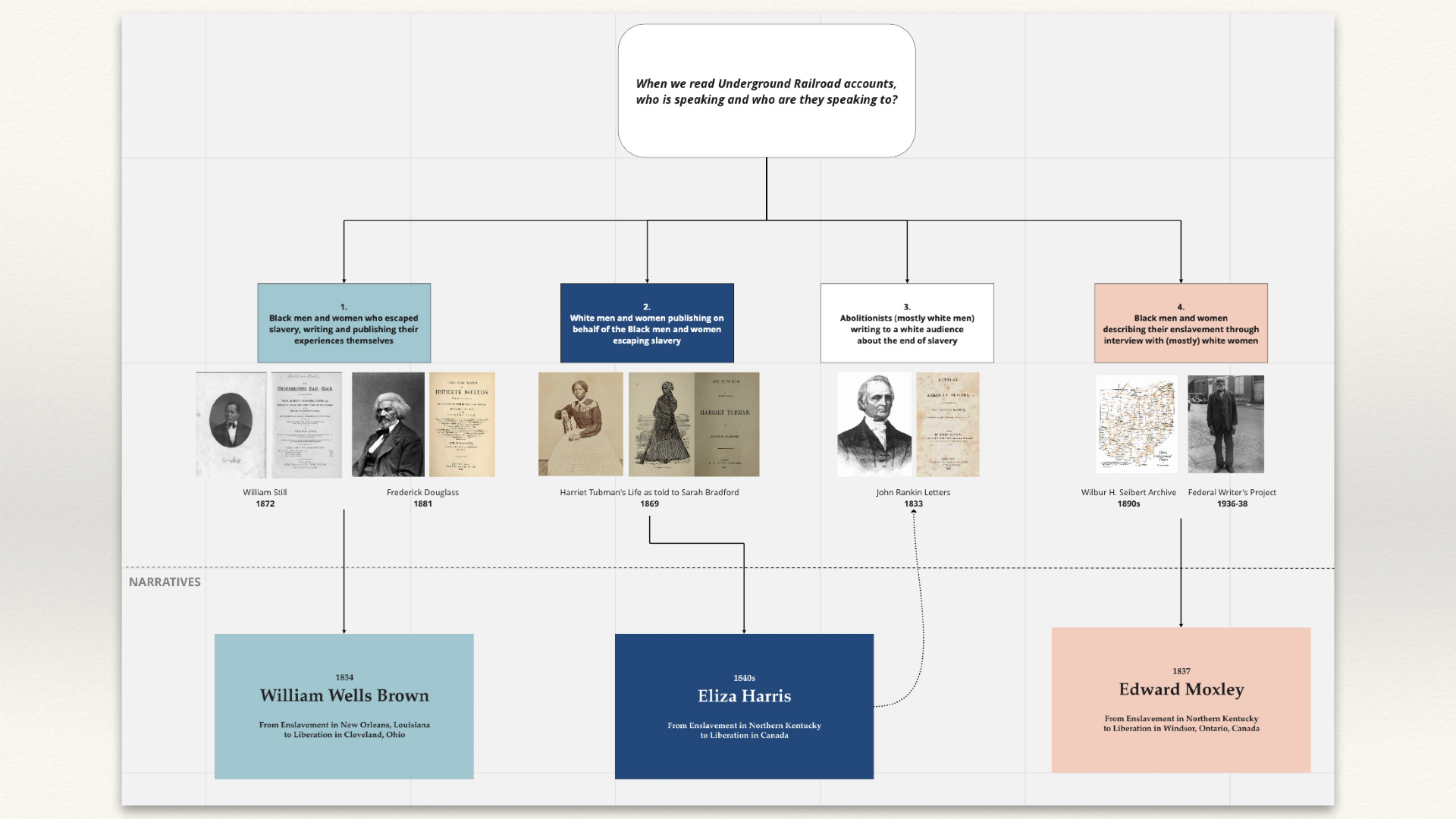
When we read Underground Railroad accounts, who is speaking and who are they speaking to? Diagram by the author.
A museum visitor standing in front of the Siebert map sees the network whole—every route, every station, the entire geography of the system at once. What disappears at that scale is the individual. The red lines do not distinguish between a journey that took three days and one that took three weeks. They do not show where the network failed, where people were caught, where the stations turned out not to be safe.
The Moxley and Eliza Harris maps were designed for a visitor already standing in front of that web of lines—to make legible what one journey looked like within it. The color, the rendering, the human scale: these are arguments about what the Siebert map cannot show. The Moxley interview is itself part of the Siebert Collection. The map and the testimony that generated it come from the same archive.
Throughout the interview, Moxley navigates not by compass points but by left and right—a squire to the left, a squire to the right, a road to the left around the town, a meeting point on the right. This is not vagueness. It is the spatial language of a body moving under pressure, oriented by immediate arrangement rather than abstract geography.
The Underground Railroad as Moxley experienced it was not a network with fixed points and stable routes. It was a sequence of barely-connected moments, each one dependent on who was present and what was happening right then. Jim Woods hid them upstairs, then moved them within the half hour because he was afraid. Banks kept them until midnight. The dock man appeared and disappeared. These were not stations—they were fleeting points of enclosure, improvised and contingent. What the map shows as a line was experienced as a series of decisions.
The Daniel Webster left Sandusky on a Friday. Saturday morning they were in Windsor. A white man who had traveled near them for two days boarded the boat at Sandusky and showed them where the ferry was in Detroit. George Walker, a cook on the Daniel Webster, gave them something to eat and told them where Canada was.
"I come here in 1837. I come away along in May. They was planting corn."
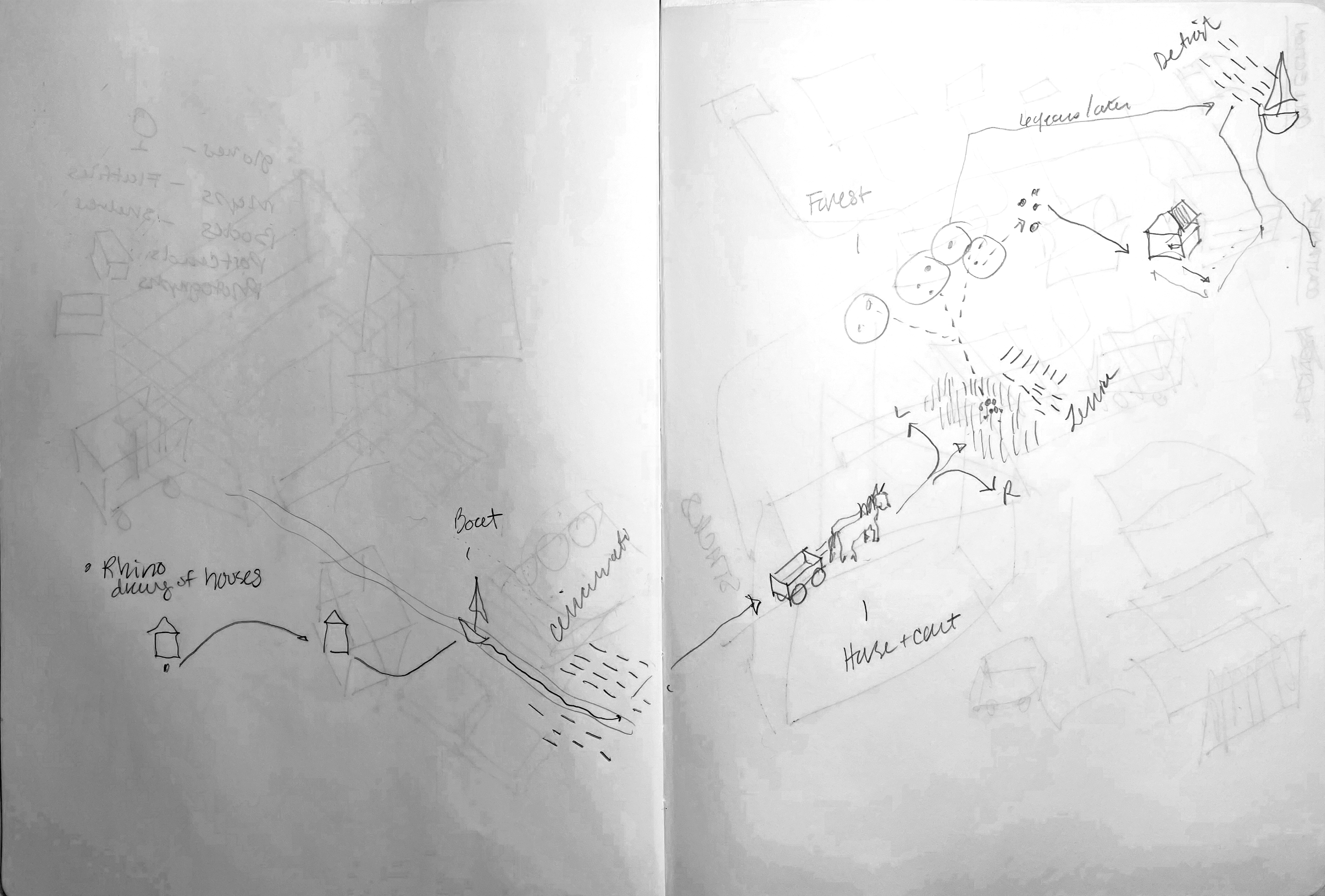
Spatializing Notes—the journey as left and right. Sketch by the author.
Moxley, Edward. Fugitive slave interview, July 31, 1895. Wilbur H. Siebert Collection, MSS116AV BOX55 06OH 036. Ohio History Connection. Ohio Memory →
Riddell's Greene County Atlas, 1896. Library of Congress Geography and Map Division. loc.gov →
Ohio. A General Atlas of the World. Edited by S.G. Goodrich. Boston: C.D. Strong, 1841. David Rumsey Historical Map Collection. davidrumsey.com →
Flat Bottom Boat. New York Public Library Digital Collections. nypl.org →
Federal Hill Mansion, Bardstown, Kentucky. visitmyoldkyhome.com →
Mount Lebanon House. Library of Congress Prints and Photographs Division. HABS KY,9-PAR.V,1--2. loc.gov →
False Bottom Wagon, Levi Coffin House. Indiana State Museum. indianamuseum.org →
Lake Erie Ferry. Maritime History of the Great Lakes. maritimehistoryofthegreatlakes.ca →
Tap outside to close